How, does it work?
Data set needed:
- First of all, you need a good DWG that uses the WCS for the coordination system.
- Next, a Revit template in which the Revit origin is obvious - I use an Origin Generic Model for that
Steps:
- Draw a Line in AutoCAD from 0,0,0 to an arbitray point close to where your project is situated
- Save that DWG and go to Revit
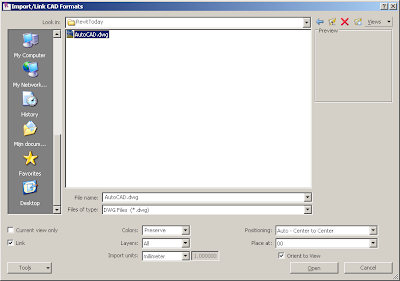
- Use Import/Link \ CAD format and choose your DWG
- It is important that you use the Link option, and choose the Center-to-Center option
- You will now see your DWG in your Revit View.
- If needed deselect the Crop View, in this way you will see the whole DWG after Zoom Extents
- Select the DWG and move (rotate if you want) your DWG eg using the arbitrary point to the Revit origin symbol
- Now, use Shared Coordinates \ Acquire coordinates to read out the coordinates from the DWG
- Your Revit project does use the new coordinates, you can show them by unsing Spot Dimension (do select Shared in the Type parameters of the Spot dimension, otherwise the Project coordinates are shown).


